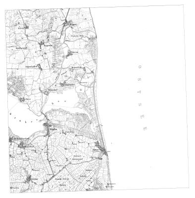
TK25 Blatt 1732 – Grube
TK25 Blatt der Königlich Preußischen Landesaufnahme 1877
Die Karten wurden in den Jahren 1878 bis 1880 durch topographische Feldaufnahmen erstellt.
Daten und Ressourcen
Zusätzliche Informationen
| Feld | Wert |
|---|---|
| Verantwortlicher | Landesamt für Vermessung und Geoinformation Schleswig-Holstein |
| Zuletzt aktualisiert | April 4, 2024, 03:46 (UTC) |
| Erstellt | Januar 21, 2024, 04:32 (UTC) |
| Contact email | Poststelle@LVermGeo.landsh.de |
| Contact name | Landesamt für Vermessung und Geoinformation Schleswig-Holstein |
| End of temporal extent | 1877-12-31T00:00:00 |
| GUID | https://opendata.schleswig-holstein.de/dataset/0fd1990a-19d8-4ac7-9747-24e0d0632cf9 |
| Identifier | 0fd1990a-19d8-4ac7-9747-24e0d0632cf9 |
| Issued | 2021-01-21T00:00:00 |
| Modified | 2021-01-22T13:03:00 |
| Publisher URI | https://opendata.schleswig-holstein.de/organization/01115337-01d1-4e96-aa8e-9749524889c7 |
| Publisher name | Landesamt für Vermessung und Geoinformation Schleswig-Holstein |
| Sprache | ["http://publications.europa.eu/resource/authority/language/DEU"] |
| Start of temporal extent | 1877-01-01T00:00:00 |
| Theme | ["http://publications.europa.eu/resource/authority/data-theme/REGI"] |
| URI | https://opendata.schleswig-holstein.de/dataset/0fd1990a-19d8-4ac7-9747-24e0d0632cf9 |
| access_rights | http://publications.europa.eu/resource/authority/access-right/PUBLIC |
| contributorID | ["http://dcat-ap.de/def/contributors/schleswigHolstein"] |
| maintainer_contacttype | Organization |
| metadata_harvested_portal | https://www.schleswig-holstein.de |
| spatial | {"coordinates":[[[10.988949,54.195808],[10.994162,54.30398],[11.176307,54.30083],[11.170619,54.192671],[10.988949,54.195808]]],"type":"Polygon"} |